


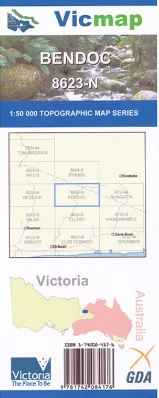
Bendoc 1-50,000 scale Vicmap Topographical map 8623N is used for Walking, 4WD, Fishing, Camping, Motorcycle, both On and Off Road, Gold Prospecting and for those simply going for a family weekend drive.
Topographical maps show not only Contours of the Terrain but Walking Tracks, Sealed and Unsealed Roads, Rivers, Creeks, Lakes, Historical Point of Interest, Old Mine Sites and National and State Park areas.
Main Features of this map includes:
The town of Bendoc and across the border Delegate
Bendoc North Bonang Sate Forest, Delegate, Mount Delegate, Delegate River and State Forest, Concordia Gully Reference Area (no public access), The Pioneer Mine (Disused), Spring Creek Gap, Bendoc, Mount Bendoc, Bendoc State Forest, Bonang State Forest, Delegate River, MOUNT KOOLABBRA, The Gap State Forest, northern section of the ERRINUNDRA National Park, Cottonwood State Forest, The Forty Four Mine (Disused), Golden Eagle Mine (Disused), VICTORIA STAR MINE Historic Area, Sleeping Beauty Mine (Disused), Musket Creek Reference Area (no public access), part of the ERRINUNDRA National Park
TINGARINGY, Dellicknora, Bonang State Forest, Roaring (Browns) Camp, Concordia Gully Reference Area, BONANZA GULLY Historic Area, Exhibition Reef Mine (Disused), Bonang, Bonang State Forest, Rodger River and Mountain Creek Natural Catchment Area, Deddick River, H O N E Y S U C K L E R A N G E, P O S T M A N S P U R, WARM CORNER TRK, MONKEY TOP TRACK, WARBISCO TRACK, HONEYSUCKLE RANGE, OLD BONANG HWY, POSTMANS SPUR TRACK, Bull Run Gap, Bowen Wilderness Zone, THE PINNACLE, Mount Tower, Mount Richardson, Mount Bowen, Monkeytop, Cabanandra, Trapyard Hill, Good Hope Mine (Disused), New Chum Mine (Disused), Who’d A Thought It Mine (Disused), Albert Mine (Disused), MOUNT KOOLABBRA, ERRINUNDRA National Park northern section, Mount Little Bill, Rising Sun Mine (Disused), Goongerah Creek


